Thanks to a joint project between Google, Charles Darwin Foundation, Catlin Seaview Survey, and the Galapagos National Park, the entire world has the oportunity to marvell with High Resolution, 360° pictures of one of the best preserved and most pristine wonders of earth, The Galapagos Islands.
The main purpose of these pictures is not only to serve as an educational support, and for scientific research, but also as a way to create conscience among the people on the importance of nature, and that it should be preserved for future generations…
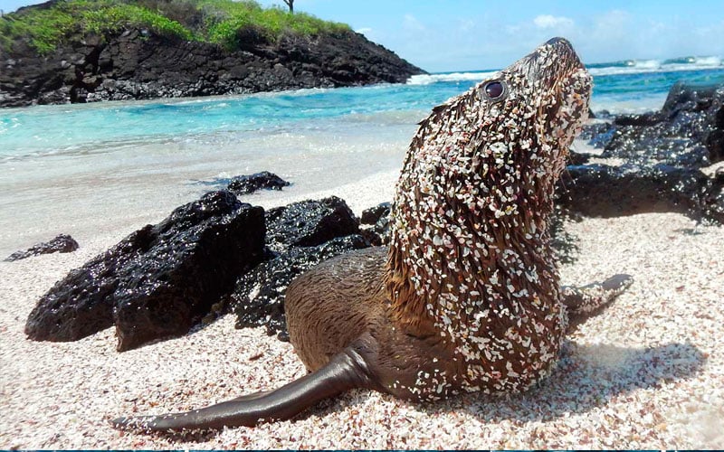
Google Street View explores Galapagos Islands. The pictures will not only show a panoramic view of the Islands but it will also give the oportunity to zoom in to specific objects, move in any direction, and have a detailed view of quite a few interesting flora and fauna of the Archipelago, as well as magnificent landscapes only found here. As you travel through the pictures you will have the opportunity to live what the staff did traveling with them and seeing what they saw.
If you want to explore the Islands in this way you have to visit the google maps, and type Galapagos in the search box, afterwards you have to drag the little orange man to where the map is highlighted in blue, and voila, you will see some amazing pictures of a unique and amazing site.
After visiting this great application you can see the real thing aboard a cruise, or taking a land cruise, you will not only see what you saw in the pictures but also feel a part of the wildlife meeting it up close, at a distance you won’t be able to in other place in the world.
A team of Experts in Galapagos are eager to help you answer any question you may have about the Enchanted Islands.
| Learn everything you need to know about Galapagos here: | |


Comments are closed